hackmatack trail racing
share the fun stuff.. .  .   .    .     .
  • Home
  • Herring Run 10/20k
  • Rompin Rockwood 10k/25k/50k
  • Results
    • Herring Run Results >
      • 2022 HR
      • 2021 HR
      • 2020 cancelled for COVID
      • 2019 HR
      • 2018 HR
      • 2017 HR
      • 2016 HR
      • 2015 HR
      • 2014 HR
      • 2013 HR
    • Rompin Rockwood Results >
      • RR 2018
      • 2017 RR
      • 2016 RR
  • Trail maps
  • Contact / About
  • Other races worth doing
  • Blog

My Sweet and Tasty Trail Running Camera Set-up

10/15/2014

5 Comments

 
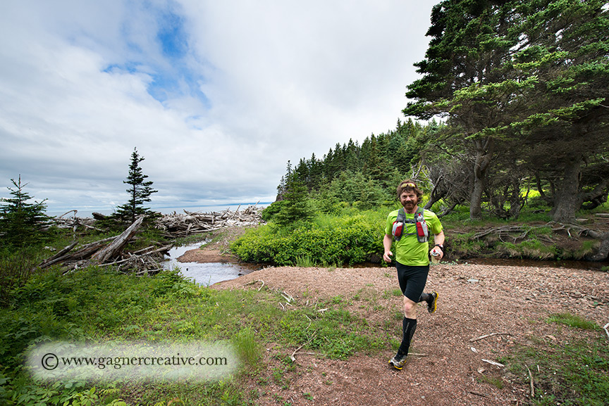
    Well, being a photographer and wanting to take pretty pictures that accurately depict where I was and the feelings I experienced there, I have always struggled with a quick and easy way to carry a nice camera with some sweet glass in a lightweight, and quickly accessible way.
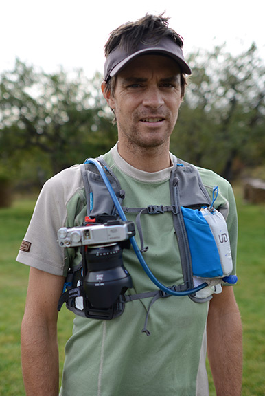
    Sweet glass and a nice camera usually have meant heavy and not light weight.  But I smartened up and got myself a Fujifilm X-E2 mirorless camera with a Zeiss 2.8/12mm (18mm full frame equivalent) to do just that. I use a B-Grip EVO Camera Belt Grip with a B-Grip Travel kit and quick release adapter to attach the camera to my Ultimate Direction Scott Jurek hydration vest.
    
I can not only hike, but run on quite technical trails at a good clip, bounce free without looking super weird and nerdy.  Just slightly nerdy, which I am OK with.


Picture
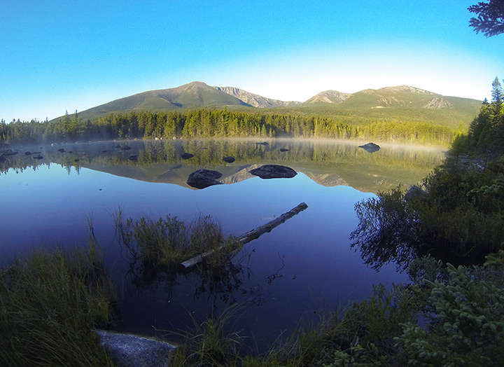
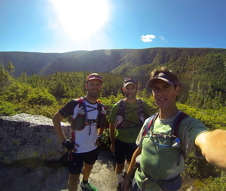
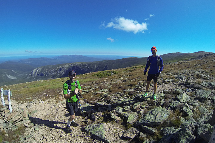
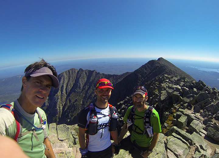
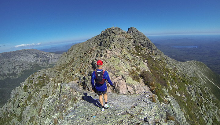
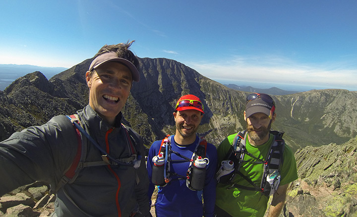
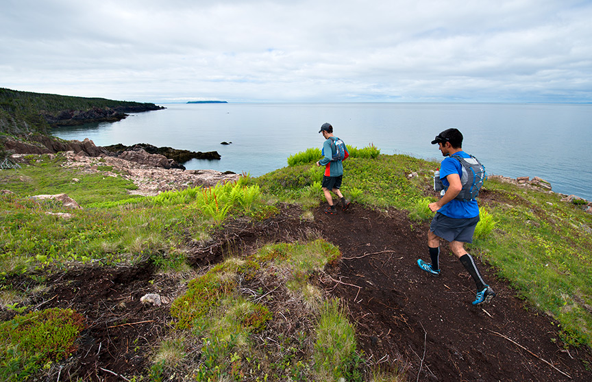
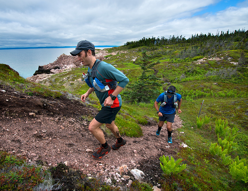
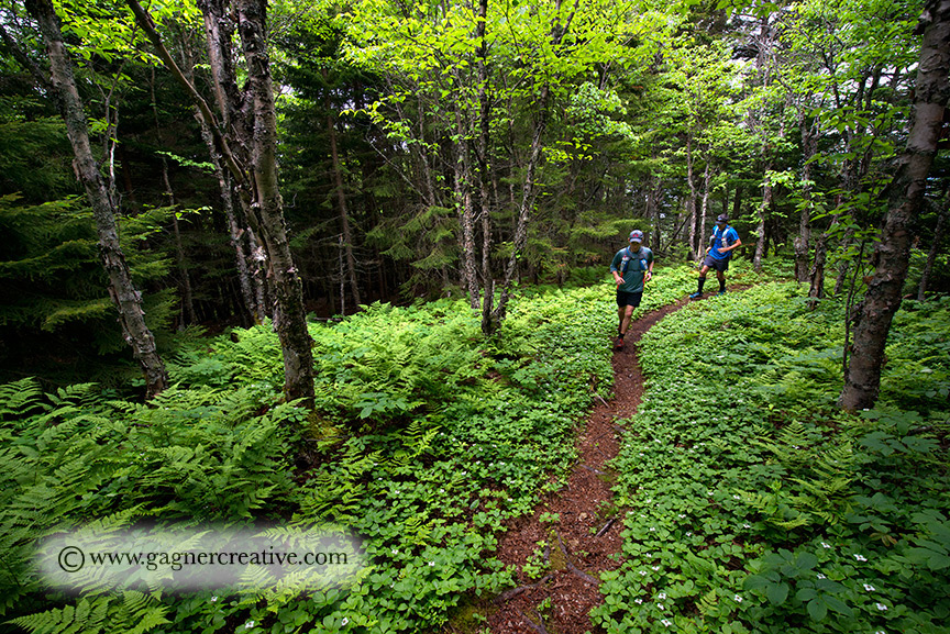
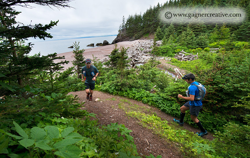
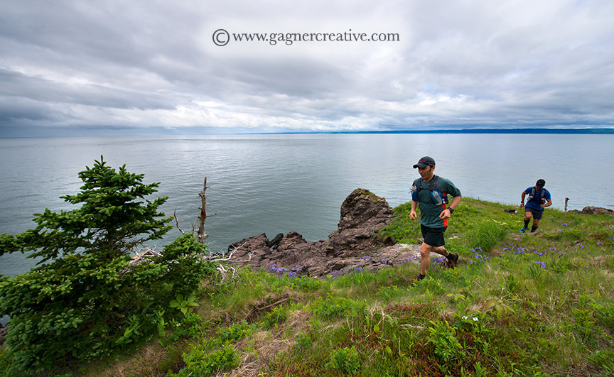
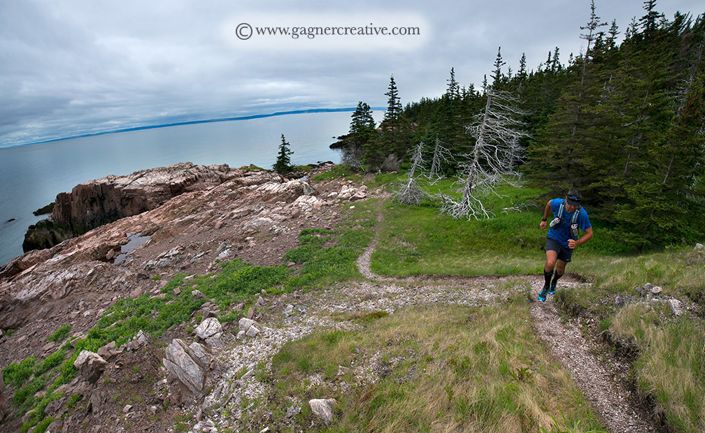
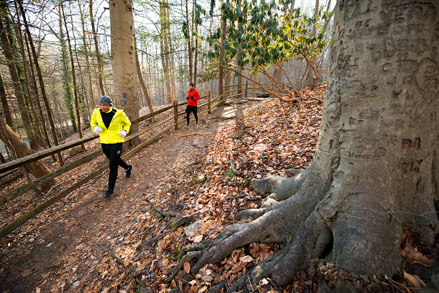
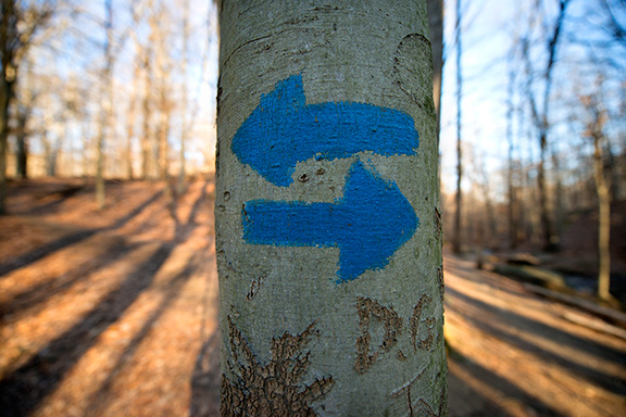
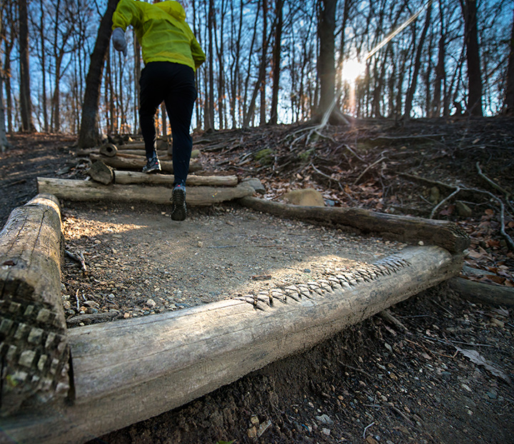
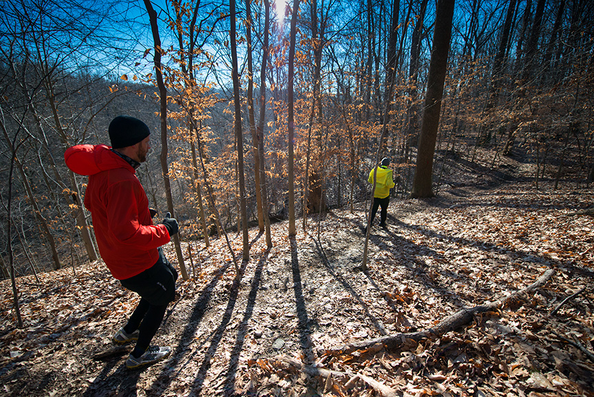
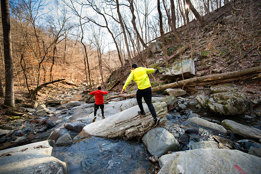
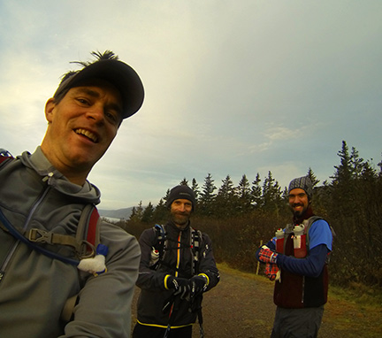
    My lovely wife Sadie took these pictures. aren't they great?
    So first with the straight poop on the vest.  It is a super light weight one with every possible consideration having gone into keeping it light.  I did make a few modifications to make it work but they were minimal. 

Picture
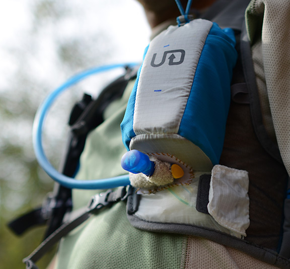
    I sewed a small patch of hook velcro to the under side of the port side bottle holder because I have found that nary a vest out there has quick, easy hydration hose attachment system off the shelf.  I actually prefer the bladder and hose style to the bottles because I find eating more of a hassle than hydration.  I had some trouble getting used to that UD Kicker valve but once you get the hang of it, it works really well.  I never thought I would have to read directions to use a water bottle but here they are. It sure helped me out.  I am now a red nipple advocate.
    One of the reasons I got this vest is so when I am running long, I can easily put 4 of my home made sweet potato-beet gels in each bottle pouch and squeeze them out as I go.  Besides, with the camera set up I am with out one bottle anyway. 

Picture
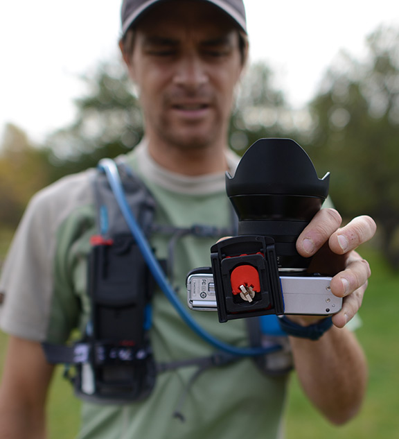
    now for the B-Grip attachment set-up.  In order to attach the B-Grip belt piece securely to the vest I had to heat up my olfa knife with a torch and send it through the Hexmesh in just the right spot to send a small strip of old headband elastic with a fastex type buckle on it for the lower portion of the B-Grip piece. The top is securely fastened with the included rubber strap.  The quick release plate  is fast and easy and has a lock too that again is easy to do up.
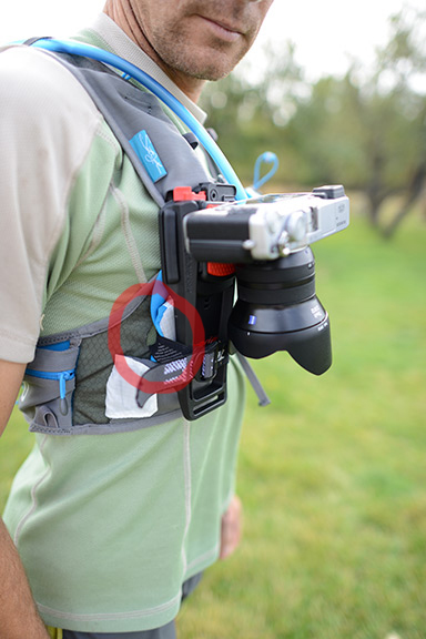
    As you can see in this photo and the next, I twisted the camera a little inboard to avoid the lens hood from hitting the extra elastic buckle I put on there.  Where did the starboard side bottle pouch go you ask?  It is squashed nicely beneath the B-Grip thingum.

Picture
See how that quick release plate is a little caddy-whompus?  That again is for lens hood clearance on my added elastic buckle.
Picture
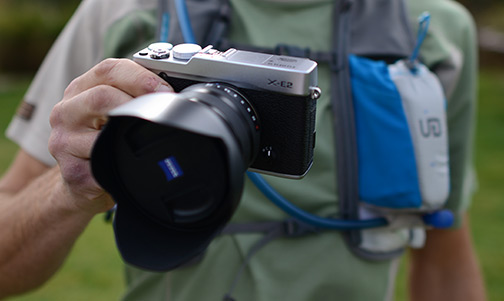
    And now for the camera and lens.  I chose this set up because it is almost half as much as my last set up.....Nikon D800 and a 14-24mm/2.8 fatty lens.  That last one was not as bad as I thought it would be, but not much better.  It was more than bulky, it was balky. 
    The Fujifilm X-E2 has a decent electronic view finder (EVF), takes 30MB, 16 megapixel RAW images and shoots up to 7 frames per second (and really does). This is essential in any camera shooting fast moving, endurance chumps and gals as they are always drooling or drooping their eyelids and this ensures that at least a few pictures are usable.  I use a plastic shower cap to put over it when it rains.  I also run without the lens cap on for quicker shooting action.
    I got the 2.8/12mm (18mm in 35mm equivalent) prime lens to go with it instead of the wider f4/10-24mm Fuji lens because it it lighter, and faster with a wider aperture.  You can never go wrong with Zeiss optics either.  Here is an in depth review of the Fujifilm X-E2.

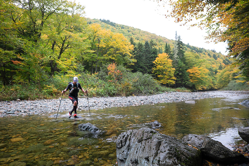
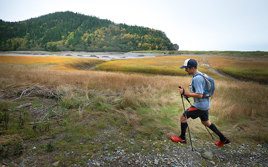
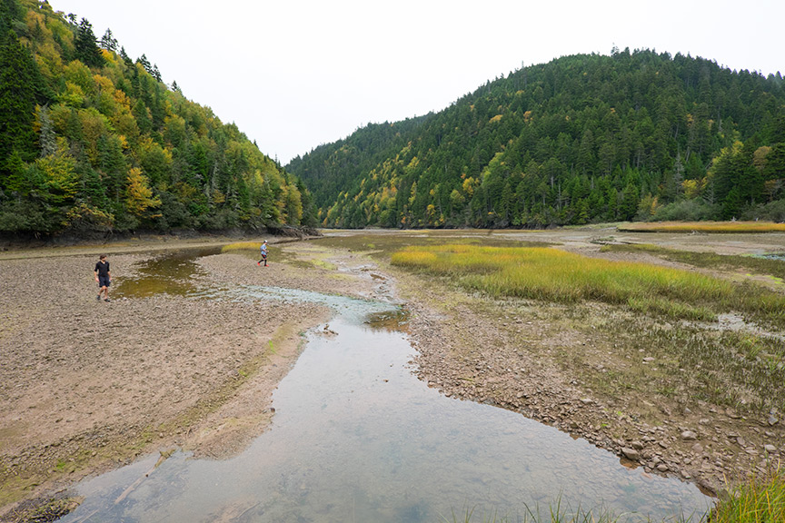
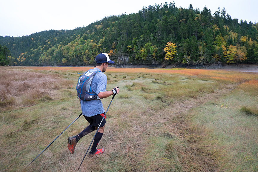
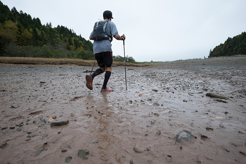
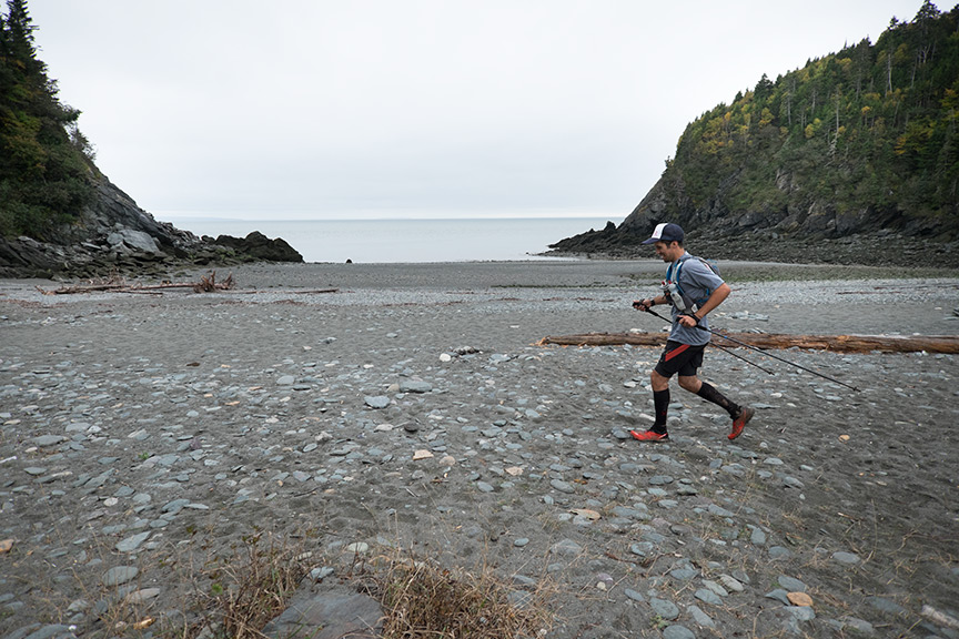
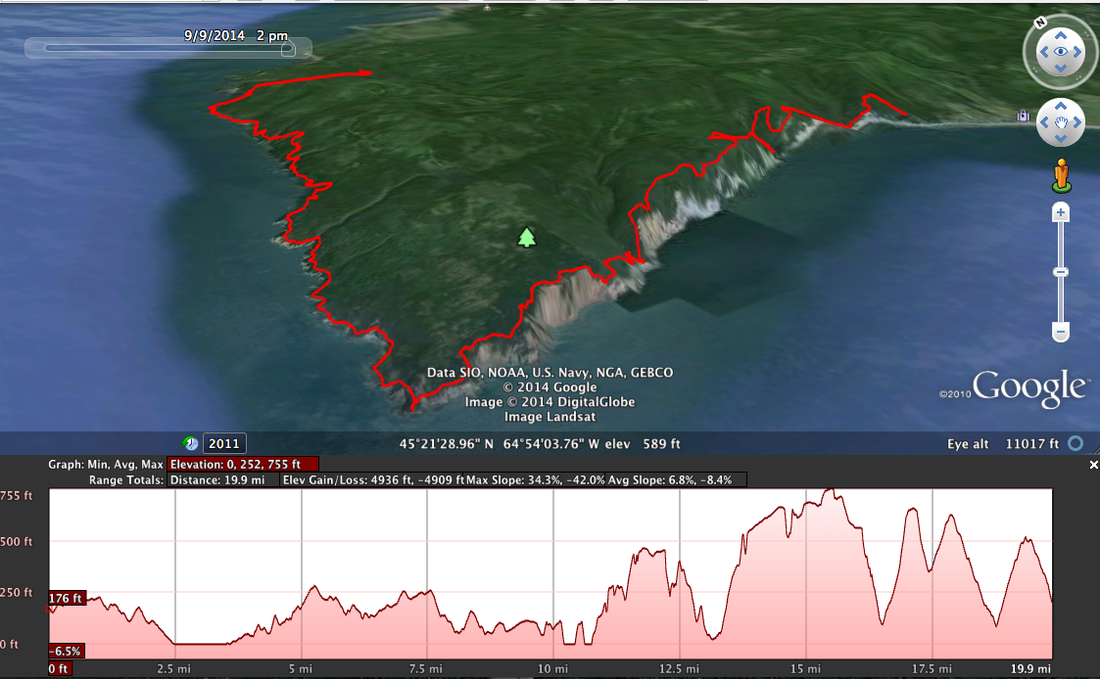
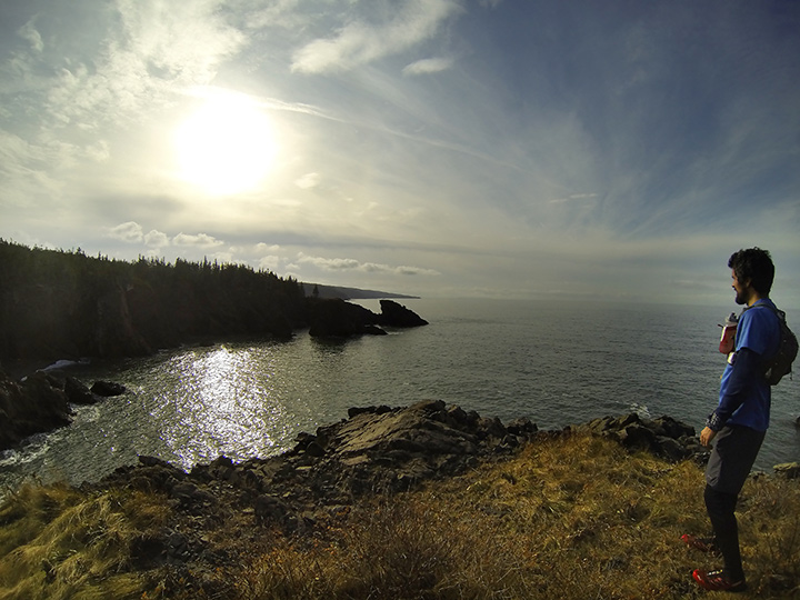
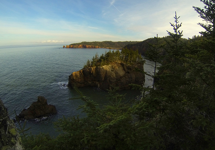
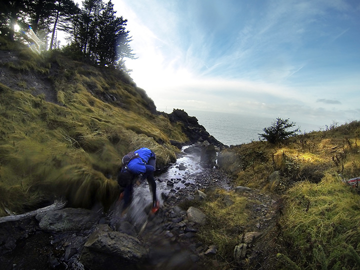
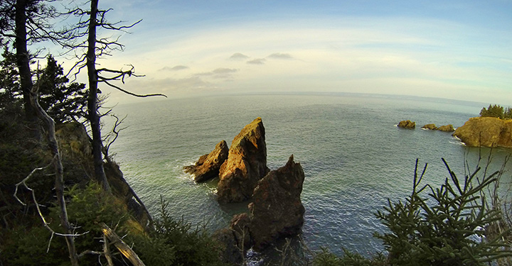
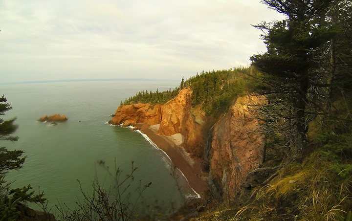
    The first time I used it I ran 25k on the Fundy Footpath with Tim Barry on his Epic 135km Fundy Trek run on October 4th. 
5 Comments

Katahdin / Russell Pond loop

10/15/2014

0 Comments

 
     I have always wanted to do this loop at Baxter state park in Maine around, up and over Katahdin.  We made a day trip out of it which made for a very long day but good times were had by all.  Shawn McCardle and I left from my house in Mascarene at 1:30 am.  That's so early, it's late!  We met Jeremy Ritcey in Woodstock at 4 am and kept on going to make our parking reservations.
     We had perfect weather, although I do prefer a little more drama, for mountain travel and we started out at the Roaring Brook trail head.  From there we went up to Russell Pond on the said trail and then took a left onto the NW Basin Trail.  Once above treeline, we continued to the saddle, up to the peak and across the Knife Edge to Pamola. Then down the Helon Taylor. 

     Some of the trails were not well maintained and so running was a bit squirrely.  The Helon Talyor was all scrubby with thick krummholtz branches continually holding you back so you had to bob and weave and bust through. 
    
0 Comments

19.5 Short Chignecto run

10/11/2014

4 Comments

 
     Well, I am a little late posting about this run as some friends and I did different interpretations of it on June 21st of this year, (2014)  We were lucky to camp that night and hang out a bit the night before. 
     Runners that came along were, Matt Tibbets, and Bruno Hache who did the whole proper loop of ~29miles, (47k).  Bernie Doucet who went for a 10 hour run around the loop and then out to us and back again for a long training day leading up to his phenomenal VT 100 run where he placed 12th.  Tim Barry and I started at Eatonville and ran a cool 19.5 miles, (31k). 

  
Picture
  I had a funky set up so I could bring along my DSLR and take snappy pictures during the run.  It was big and lumpy but it worked.  I have a much lighter and less bulky set up now that I will post about later.  It was a great run though and I really have to thank all the guys for letting me pass them continually as I ran ahead to catch them at scenic sweet spots, letting them run by, and then letting me pass again for another go at the next photo op.  So thanks for your patience all. 

Here are some pictures from that run, Enjoy.
4 Comments

The Fitz Frenzy trail run is coming up folks!

5/13/2014

0 Comments

 
So this year the Fitz Frenzy trail race in Scotsburn, NS is offering a 7k, a 14k and a 21 k (for which I am the only ow signed up so far) and it should be fun.
Here is a map of the route;

Picture
AND. . . .  the site to register at: Fitz Frenzy Reggie page

I hope to see you there!
0 Comments

20 miler on Massanutten Mt. VA

1/21/2014

0 Comments

 
     Well, no pix this time.  What a fun run though.  This was the longest I have gone since Chignecto at 29 miles but I felt much better this time.  Tired but no aches. I think I just showed myself what I can do if i take it easy, eat right and just keep going.
     I started at the Buzzard Rock trail head and went up the ridge.  there was only 2" of snow at the higher elevations on the north side of the mountains which was a nice treat for a northerner. I did it in 3:58 which I thought was good. I certainly was not ready for the hills.

Picture
Here is a Google Earth link for anyone who cares........ . . .
massanutten_20.kmz
File Size: 60 kb
File Type: kmz
Download File

0 Comments

Patapsco Valley State Park, Maryland, USA

1/21/2014

2 Comments

 
PictureThe Cascade in Cascade Trail.
     On a whim I decided to Facebook Ryan Seth of the Annapolis Running Shop in Maryland, USA for some tips on trail running in the area.  Here is their FB page as well.  Ryan rustled up some savvy trail runners and we headed out to Patapsco Valley State Park just to the east of Baltimore, MD.  Check out their site as their PDF maps are printable and highly detailed.

Thanks again Ryan and Josh for coming with me, enduring my calls for reshooting pictures and worse, running that hill just one more time!  I had a great run and hope to come down again sometime.
Picture
Heading down the Cascade Trail.
It was such a treat for me because of the 40-50 F weather and no snow or ice.  The trails were in great shape as well.
Picture
Most trails are well marked.
Picture
Buzzard Rock Trail
Picture
Saw Mill Trail. We lucked out with glorious weather.....for a Canadian!
Picture
Saw Mill Trail, technical creek x-ing fun
2 Comments

Cape Chignecto Run, 11/16/13

11/24/2013

4 Comments

 
The weather was perfect, which is odd for mid November in the Maritimes. We happily, and I a little anxiously, grabbed our chance.  Happy, because Tim Barry, and I would be running along some 20 miles of cliff ridden, wilderness coastline at the head of the Bay of FUndy.  Anxious because it is a 29 mile loop through Cape Chignecto Provincial Park with 7350 feet of elevation gain.  My longest up to this point was 18 miles in Acadia NP this past summer with ~5000 feet of gain. That felt great.  Would this? 
   
Picture
     Shawn McCardle accompanied us for the first 4k and give us the ol' one, two on the loop as neither Tim nor I had run this here before. Before I get too into it, this was certainly one of the best runs of my life.  The video speaks to that.  The skinny? 8 hours, 50 minutes.
Picture
Here is the Cape Chignecto Provincial Park Site.  But here is a link to a better map.  It is actually the map from page 2 of the downloadable brochure on the park site. 
     As for details;   We started at the Park Office as there was a gate there.  We went in the off season and so didn't have to pay a fee but next time I may do it in season not only to avoid leaves on the trail (a pet peeve of mine) but also to help out with funding trail work and park upkeep. 
   

Picture
The trail itself was quite runnable I thought and well trodden. There were a few downed trees here and there and some of the smaller dirt/log bridges were rotting.  The bridges over the bigger creeks were robust and in good condition.  We lucked out with a sunny spell the whole week prior which made the trails mostly dry.  We chose, and were encouraged by some heroes of mine, to start with the inland section an save the coast section for the reward as well as two steep, long hills for dessert near the end.  There were numerous look-offs and view points that we took advantage of. 
    
Picture
We used a Stari-Pen Freedom to treat our water as we dipped into steams as we needed. The Steri-Pen works with a UV LED to mangle micro organism DNA so they can't reproduce.  You just swirl it around in your water for about 50 seconds per liter and off you go. No waiting like with Aqua Tabs, although we brought some in case things got ugly.
   
Picture
     I lucked out with stomach issues this time as I had an S-Cap every hour and a Clif Bar every hour after the first hour and a half.  About half way through, at Keyhole Brook, the outside of my left Knee started hurting on the downhills and got progressively worse so that I had to walk uncomfortably down the hills.  Flats and uphills were fine.  Weird because I was expecting old injuries to poke their ugly noses in my face again, but this was an entirely new one. That slowed me down quite a bit.  Tim had some tummy troubles at about the same point after eating an Clif Shot that was Robotussin flavoured.  That slowed him down a bit and so we were well matched.  He got over his trouble before Refugee Cove though where I still had a few big hills to stumble down. Tim stuck with me on the down hills and we had yapped a good bit about kids, life and what we were going to eat as soon as we got back.
Picture
By the time we got to Mill Brook we were still in good spirits though. I had run out of Clif Bars and had 6 Clif Shots left. I went for vanilla as a safe bet for the taste buds.  I ate 3 at once and Tim cautioned me that this was kooky, most people only have one every 20 minutes.  I worried a little and then crested out at the top of Mill Brook and all was peachy.  
    We were supposed to run this loop with 6 or 8 other trail running buddies from NB, but life gave them another twist.  We missed them on this run and know there will be many others in the years to come.  We thought about you all and will share another one, another time.  Maybe with even better weather. 

Cheers.
4 Comments

Turtle Mountain trail, Grand Bay - Westfield

11/13/2013

0 Comments

 
This video of the Turtle Mtn run starts at the bridge between Robin Hood Lake to the right (north) and Little John Lake to the left (south).  We did see some 4 wheelers and side-byes on the trail. All of them were friendly and encouraging when they learned of our plans so be sure to say Hi and a thumbs up for givin' 'er.
    Starring Tim Barry's backside.  Next time I will be sure to capture a selection of views.  Enjoy.
turtle_mtn.kmz
File Size: 0 kb
File Type: kmz
Download File

Here is a much better description below in PDF to help you get your gumption on
turtlemountain.pdf
File Size: 3626 kb
File Type: pdf
Download File

This was quite a fun trail at ~14.5ish miles (23.6 k) round trip mostly on well cleared 4 wheeler trails.  It was a bit wet when we did it and so it would be even nicer in dry times. The first few miles are on rough gravel road that would be OK for  a Toyota Matrix but unwise for a Porshe.  
     Once you get close to the summit of Turtle mtn, yo are faced with a very steep climb up smooth granite ledges.  The view is pretty neat as you will see at the end of the above video with Turtle Lake below to the south and The Bay of Fundy in the distance. 
     We started at the round tunnel..... . . . it seemed like a good spot.  The road to get to this quasi trail head was a bit hard to find so i have a google street view picture below.

View Larger Map
It kind of looks like someones driveway but keep going past some old buildings and the road gets a little rougher.  Keep going and you can't miss the round tunnel.  If you start at the west side of the tunnel, go left.
0 Comments

Irving Nature Park,  from Sheldon Point.

11/13/2013

0 Comments

 
This run started from the Sheldon Point Trail head just after the big barn on your left on Sand Cove RD. on the way to Saints Rest Beach in West Saint John. It is 9.85 miles or 15.85 K.  
     The picture on the Google maps link with the silver van and land rover was taken when the park is closed.  (Check the Irving Nature Park site for dates and park maps) You can still park here though.  This portion of the trail dips behind the barn, takes a hard right and follows an old dirt road for a wee bit then goes up to some nice single track that takes you through south facing slopes with mature, but gnarled from the coastal winds, yellow birch and other hardwoods.  You will run right by the Sheldon point lookout so stop and have a view.  After that you will wind through a bit of alders and then parts of a gravel pit that finally dumps you out at the beach.  Run along with the eroded sand bluffs to your right to eventually get to the Saint's Rest beach proper and the causeway. This takes you to the main part of INP where you can follow the perimeter trail through mossy spruce forests, across small, intimate beaches and even some hardwood groves.
      You will end up back at the causeway and so can retrace your steps from there. A Google Earth track is on the link below. 
long_inp.kmz
File Size: 59 kb
File Type: kmz
Download File


View Larger Map
0 Comments

Tim Barry completes the 58k Dobson trail

10/7/2013

3 Comments

 
Congratulations to Tim Barry who completed the 58km Dobson trail yesterday in 9~ hours. ( His GPS watch died just after 8 hours) From the northern edge of Fundy National Park to Riverview, NB, Tim ran over rolling hills and peak foliage to finish in just over 9 hours.  I had the pleasure of meeting him along the way to resupply his needs and his Mom even met him halfway as well with all kids of yummy and healthy things.  Thanks to Tim's Dad for driving my car to the next meeting spot and navigating on rough roads, enabling me to run 10k with him.  His Mother ran him in through the final 15k.  His wife, Denise and kids even met him 1 k in and surprised him with a an escourted run out. Thanks for the opportunity to help you along the way and for the great meal at Calactus afterwards.
Nice Tim.
3 Comments
<<Previous

    Bryan Gagner

    I have been trail running for about 30 years and am rejuvinated by it. Breathing deeply in the woods and wild places is something everyone should do, what ever their capability.

    categories

    All
    Injuries And Prevention
    Nutrition
    Race Resume
    Rambles
    The Herring Run

    Archives

    August 2019
    September 2015
    October 2014
    July 2014
    May 2014
    April 2014
    January 2014
    November 2013
    October 2013
    September 2013
    August 2013
    July 2013
    June 2013
    May 2013
    March 2013
    December 2012

    RSS Feed